Space missions are the pioneers of human civilisation, and no matter the country, these are sources of pride for every single human being on Earth. One such monumental space mission that will have a great positive impact on the world is the NISAR mission—it’s a collaborative effort from the two biggest space agencies in the world, NASA and ISRO.
The goal of the NISAR satellite is to monitor the Earth using the latest RADAR technologies. This will help scientists better understand the impact of environmental factors like volcanoes and earthquakes on the Earth’s surface. Not only that, but the studies from the generated data will shed light on climate change, glacial rivers, deforestation, and more.
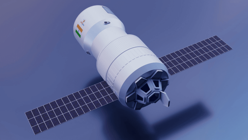
NASA-ISRO Synthetic Aperture Radar
The synthetic aperture radar is high-tech and can generate both 2D and 3D images of the surface. The NISAR mission will use the L-Band of NASA and the S-Band from ISRO to generate 85 Terabytes of data daily. Moreover, the satellite will be launched using the GSLV Mk-II rocket in India.

Regarding the capabilities of NISAR, it can penetrate through clouds and observe geological changes day and night. In addition to its efficacy, the satellite will transmit high-quality data for over 3 years, which is helpful for understanding oceanic and tectonic plate shifts/changes.
Goals and Objectives
The NISAR mission is promising in each and every aspect of scientific studies. The satellite can monitor environmental changes in a way that is beyond current technologies. Also, scientists can map agricultural patterns prior to natural calamities alongside glacier retreat, ice-cap melting, or rising sea levels.

- Monitoring global environmental changes like climate change.
- Measuring Earth’s surface movements
- Keeping an eye on natural disasters and phenomena, including earthquakes and volcanic activity.
Some Promising Features of NISAR Satellite
As mentioned earlier, the NISAR is a one-of-a-kind mission where the satellite will work on an advanced dual-frequency radar for collecting data. Thanks to its large antenna, which can measure surface changes up to a few millimetres; it has one of the most extraordinary imaging capabilities.
Positive Impact Of The NASA-ISRO Partnership
NASA and ISRO are two of the most prominent space agencies in the entire world. The two organisations are hubs for some of the world’s most talented and genius people. So, it’s a significant step or initiative from both sides to promote collaborative space research. Not only that, but it will also be a resourceful step, as both agencies are pooling around 1.5 billion dollars.
Major Applications of the NISAR Mission
The Earth is in the middle of a natural and man-made crisis—climate change, pollution, and local or global wars are changing the planet’s landscape. However, with NISAR, scientists can look into the first half of the issues.

NISAR opens doors for better resource management, which will positively impact the environment. It starts with monitoring coastal ecosystems and wetlands most prone to natural disasters. On top of that, the data generated by NISAR will help for better urban planning and infrastructure development.
- Flood and drought prediction.
- Early warning systems for tsunamis, landslides, and earthquakes.
- Enhancing scientific research in Earth sciences.
NISAR Will Also Promote Technological Innovations
The deployment of the world’s most advanced RADAR system will utilise the best technologies out there. First, it comprises real-time insights that will also promote remote sensing technologies. Second, scientists can implement and use predictive analysis on the generated data.
Overcoming Challenges And Reaching Milestones
The NISAR mission will have many challenges to overcome—everything from design to launch is a timeline of endless errors. Not only the bugs in development but also integrating different technologies and finalising testing are some of the few issues. However, if everything goes according to plan, NISAR will achieve milestones like integrating L and S-band systems.
Global Impact Of NISAR Mission
The NISAR satellite promises to contribute to the UN’s sustainable development goals. This will help independent nations make better decisions regarding their environmental policies. On top of that, scientists will have more data to promote better decision-making in the legislature. Finally, the success of such missions will foster future collaborations and friendly initiatives for a peaceful tomorrow.

Launch and Timeline
The expected launch date of the NISAR mission is March 2025. However, it all depends on the frequency and testing of work. It will take place in India using the GSLV Mk-II rocket, but there are still some expected updates about the project.
Key Takeaways
- NISAR is a collaborative effort between NASA and ISRO, aiming to monitor Earth using the latest RADAR technologies.
- The mission will use the L-Band of NASA and S-Band from ISRO to generate 85 Terabytes of data daily.
- The satellite will penetrate through clouds and observe geological changes, transmitting high-quality data for over 3 years.
- NISAR is a unique mission with an advanced dual-frequency radar for data collection, with a large antenna capable of measuring surface changes up to a few millimetres.
- The mission will monitor global environmental changes like climate change, measure Earth’s surface movements, and monitor natural disasters and phenomena.
- The partnership will promote collaborative space research and pool around 1.5 billion dollars from both agencies.
- Major applications of NISAR include monitoring coastal ecosystems, predicting floods and droughts, and enhancing scientific research in Earth sciences.
- The mission will promote technological innovations, including real-time insights and predictive analysis.
- Despite challenges like design and launch errors, NISAR is expected to contribute to the UN’s sustainable development goals and promote better legislative decision-making.
- The expected launch date is March 2025, with updates on the project.
Frequently Asked Questions (FAQs)
Who launched the NISAR satellite?
NASA and ISRO are planning to launch the NISAR satellite in early 2025.
What does NISAR stand for?
NASA-ISRO Synthetic Aperture Radar.
Who introduced NISAR?
NASA and ISRO.
Which is the ISRO’s first Indian satellite?
Aryabhatta is ISRO’s first Indian satellite, launched in 1975 by the Soviet Union.
What is the NISAR mission upsc?
The extraordinary mission aims to capture Earth using the leading RADAR technologies of both NASA and ISRO in a single satellite.
What is a SAR image?
Synthetic aperture radar or SAR images are produced by a system that sends microwaves from sensor platforms to the ground and collects the reflected waves.
In which year will NISAR be launched?
March, 2025.
What is the mission of NISAR 2025?
NISAR is one of the most advanced satellite technologies, and it has a lot of real-time applications, especially in detecting geographical and environmental changes. It can help scientists to understand the Earth’s changes more precisely and rapidly.
What is the motive of NISAR?
The main motive of NISAR is to map a detailed view of the Earth’s surface for geological and ecological changes.